
8/5 Forecast
1. Pressure System
1. Surface Pressure


-
The low-pressure system near the Korean Peninsula has dissipated, and a high-pressure system has formed, resulting in clear and cloud-free weather.
-
At 21 KST, the high-pressure system over inland China moves eastward, approaching the Korean Peninsula.
2. 850hpa


-
The center of the high-pressure system remains over the Korean Peninsula, maintaining a generally stagnant pattern.
-
Temperatures aloft are similar to the previous day, but by 21 KST, isotherms shift northward, indicating rising temperatures.
-
A clockwise flow brings in weak southwesterly winds. Warm advection is forming, increasing the chance of warm air inflow.
-
Wide contour spacing and persistent high pressure limit atmospheric mixing, making nighttime cooling difficult and raising the likelihood of tropical nights.
2. Wind
850hpa Stream Line & Isotach


-
At 850 hPa, a anticlockwise flow forms along the low-pressure system over northern Korea, with areas where wind speeds exceed 25 knots.
-
Under the influence of this cyclonic circulation, southwesterly winds dominate over the peninsula, and streamlines are relatively dense, indicating organized airflow.
-
By 21 KST, the influence of the northern low weakens, streamlines over the peninsula become more widely spaced, and a generally weak, stagnant wind pattern is observed.
3. Precipitation/ Humidity

High likelihood of precipitation, especially strong convective precipitation in central inland and west regions.
High moisture convergence with southwest wind-based lower jets, and 35-40 K-index overlap, resulting in local torrential rain, thunderstorms, and gusts.
01
850hPa Moisture Flux
-
Wet southwest wind air flows in over the Korean Peninsula. Moisture converges to central and southern parts of the Korean Peninsula
-
Water convergence from the southwest sea to the inland of the Korean Peninsula -> High likelihood of precipitation
03
850hPa Streamline and Isotach
-
There is a lower jet flowing from the southwest to the northeast.
-
In particular, strong wind bands with wind speeds ranging from 25 to 50 kt from the southern sea to the Korean Peninsula are introduced
-
High likelihood of convective activity with active water vapor transport
02
1000-500hPa Thickness & 700hPa T-Td
-
Dense stratum line in the northern part of the Korean Peninsula -> Changes in barometer active
-
Distribution of low wet water values in central inland and southern parts -> Humidity high
-
High probability of precipitation
04
K-index
-
Overall, it is distributed over 30 to 40 and above, especially in the central inland and southern regions
-
When combined with marine tropical end and lower jet in summer, the possibility of strong thunderstorms or local heavy rain is very high
-
Thunderstorm intensity is also high → Lightning, gusts, and local torrential rain warning.
4. Cloud
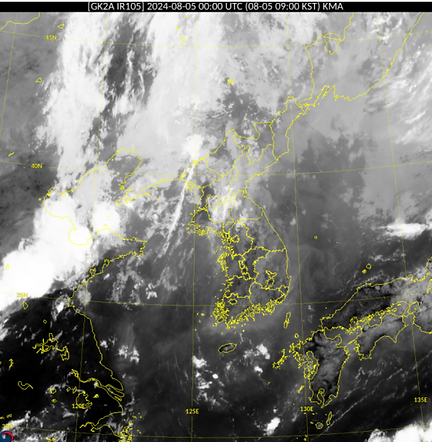
-
Irregular and scattered low-level clouds of gray to medium brightness are widely distributed across the Korean Peninsula.
5. Temperature
2024.08.05|21KST

-
As of 9 AM on August 5th, following the dry adiabat line from the 850 hPa temperature on the thermodynamic chart down to the surface, the maximum temperature is expected to be approximately 34°C.
2024.08.04|21KST

As of 9 PM on August 4th, the minimum temperature in Seoul on August 5th is expected to be approximately 26°C.
8/5 Observation
1. Wind


2. Precipitation


Heavy rain warnings in Chungcheongbuk-do/Chungcheongnam-do, Gangwon-do, and parts of southeastern Gyeonggi-do
There was precipitation with strong gusts across the country.
3. Temperature


-
Daily average
→ All of South Korea is recording high temperatures around 30°C or higher
-
Climate deviation
It looks less pink than the day before, and some areas have a temperature deviation of +-0.5°C
-
Standard score
Most of the regions in the country's Z-Score is 0.25, 0.5 or higher, and there are also regions having Z-Score of +-0.25
-
Maximum temperature is 33.7°C, 2.7°C above last year(31.0°C)
-
Minimum temperature is 26.9°C, 2.8°C above last year(24.1°C)