
Wind
Overall weak wind speeds suppressed atmospheric mixing,
while southwesterly winds continuously brought in warm and humid air, creating a stagnant pattern.
Especially at 21 KST, wind speeds were weaker than during the day,
limiting effective release of radiant heat.
This persistent atmospheric stagnation contributed to the retention of warm air
and the occurrence of heat waves and tropical nights.
Wind Speed
Observed Wind Speed
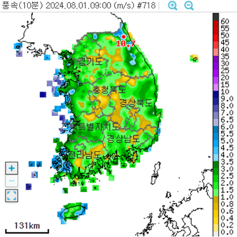
Across the country, wind speeds mostly remained weak, below 4 m/s,
suppressing atmospheric mixing and creating conditions
favorable for the accumulation of radiant heat near the surface.
From August 3rd to 7th, wind speeds dropped further, causing stagnant air flow,
which likely contributed to the prolonged heat waves and tropical nights.
At 21 KST, wind speeds weakened even more compared to daytime,
limiting the effective release of radiant heat and trapping warmth near the surface.
This persistent atmospheric stagnation, along with the retention of warm air,
was a key factor in intensifying heat waves and tropical nights.
Wind Direction
850hPa Stream Line and Isotach
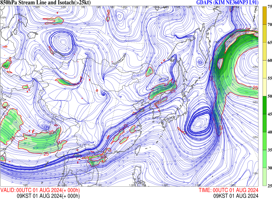
In August 2024, the Korean Peninsula was under the influence of high pressure,
with prevailing southwesterly and southeasterly winds.
These winds acted as a continuous pathway, bringing warm and humid air from the southern seas.
As a result, atmospheric moisture remained high, increasing the apparent temperature.
Warm air inflow continued at night, suppressing radiative cooling
and preventing temperatures from dropping sufficiently.
This sustained warmth contributed to the increased likelihood of heat waves and tropical nights.
Jet Stream
IDV - 300hPa u wind (Jet Stream)
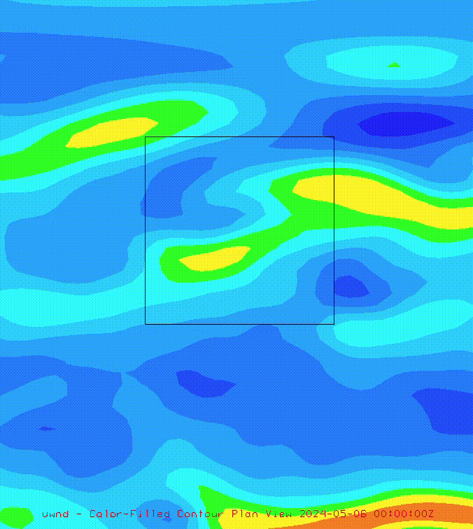
2024/05/01 ~ 2024/05/07
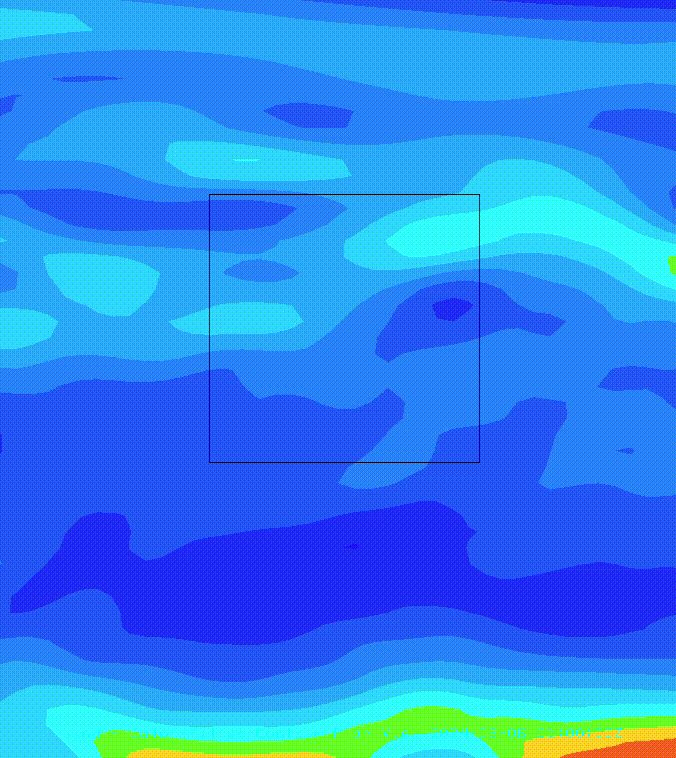
2024/08/01 ~ 2024/08/07
-
Black Square : Centered around the Korean Peninsula
Unlike in May, when the jet stream typically passes over the Korean Peninsula,
in August during the heat wave, the jet stream weakened and shifted northward.
The jet stream, a strong upper-level wind, plays a key role in moving surface pressure systems.
When the jet stream weakens or shifts away, the movement of high
and low-pressure systems slows, leading to stagnant atmospheric conditions.
300hPa
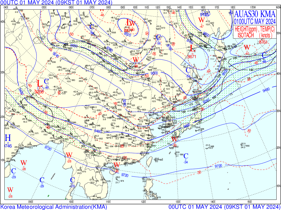
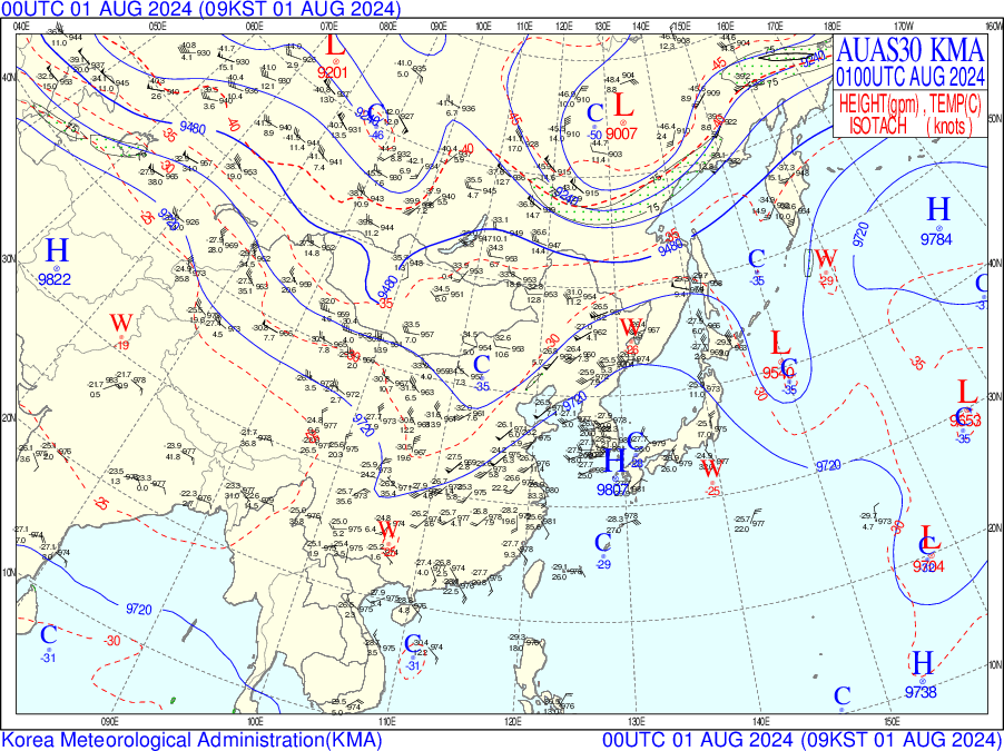
The 300 hPa analysis charts also show differences
in the jet stream patterns between May and August.
In August 2024, the North Pacific High strongly expanded and stagnated.
As a result, the upper-level jet stream was pushed northward and disrupted
compared to average years, causing the high-pressure system to remain stationary
over the Korean Peninsula for an extended period.
As a result, clear skies persisted, and the heat wave continued.